German-Land: Language beyond Borders (1867)
Abstract
Geographer and cartographer Heinrich Kiepert (1818–1899) was most famous for his historical topography of Asia Minor and the eastern Mediterranean. This color map from 1867 is titled “Map of Peoples and Languages of Germany and its Neighbors.” As ethnographic representations of the cultural nation [Kulturnation], maps of this sort enlisted the modern science of statistics to create and demarcate linguistic communities.
Source
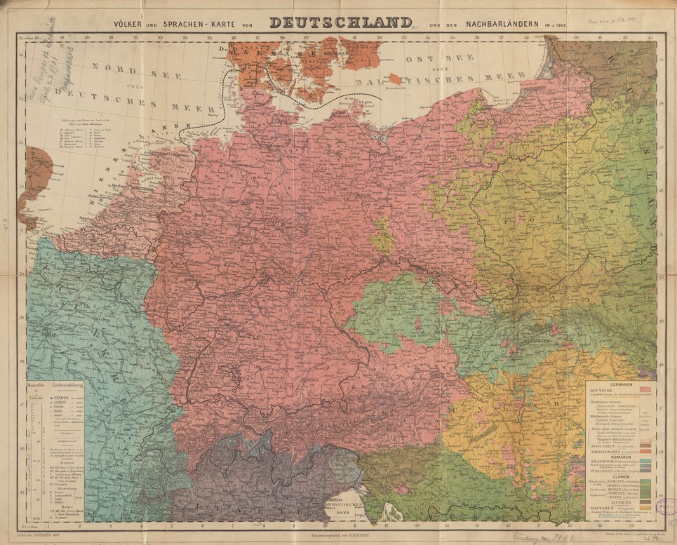
Source: Heinrich Kiepert, “Völker und Sprachen-Karte von Deutschland und den Nachbarländern im J. 1867” [“Map of Peoples and Languages of Germany and its Neighbors in the Year 1867”]. Berlin: Dietrich Reimer, 1867. Norman B. Leventhal Map & Education Center at the Boston Public Library, https://collections.leventhalmap.org/search/commonwealth:4m90fp81w
Norman B. Leventhal Map & Education Center at the Boston Public Library
Further Reading
Jason D. Hansen, Mapping the Germans: Statistical Science, Cartography, and the Visualization of the German Nation, 1848–1914. Oxford: Oxford University Press, 2015.