Europa as “World Ruler” (1588)
Abstract
“Europa prima pars terrae in forma virginis” (Europe, the first continent, in the form of a virgin). The map shows Europe as a female figure endowed with imperial attributes. Cartographer Heinrich Bünting (1545–1606), a pastor from Goslar depicted Europe as a world ruler with the following hierarchy within the continent: head = Spain; heart = Germany, respectively Braunschweig, the homeland of the author (his work was dedicated to the sovereign of Braunschweig); lower part of the hierarchy = the Balkan peninsulas conquered by the Ottomans. The depiction reflects, on the one hand, the world order supposedly established by God and, on the other hand, the patriotic sentiment of the author—the Old Empire as a whole, but also focused on Braunschweig.
Source
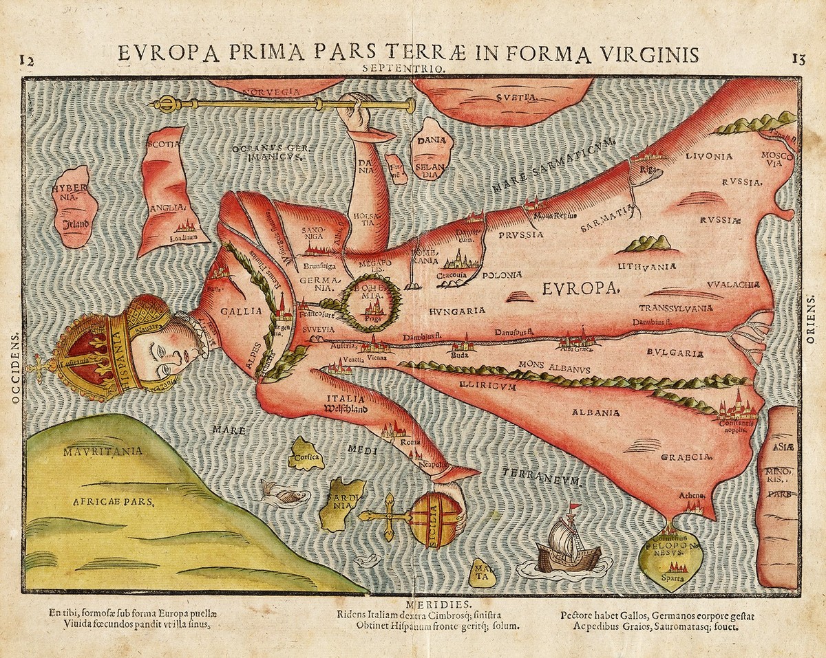
Source: Heinrich Bünting, Itinerarium Sacrae Scripturae: das ist ein Reisebuch über die ganze Heilige Schrift. Wittenberg, 1587, p. 12f., Deutsches Historisches Museum, Berlin, Inv.-Nr.: Do 2001/49.
© Deutsches Historisches Museum, Berlin
Further Reading
Bettina Brandt, Germania und ihre Söhne. Repräsentation von Nation, Geschlecht und Politik in der Moderne (Historische Semantik, vol. 10). Göttingen: Vandenhoeck & Ruprecht, 2010.