The World as an “Earth Apple” (c. 1491–94)
Abstract
The globe or “earth apple” [Erdapfel] by Martin Behaim (1459–1507) from Nuremberg is the oldest extant representation of the earth in spherical form. It shows images of rulers, coats of arms, mythical creatures, and exotic animals, and thus conveys contemporary geographical and historical knowledge at the end of the Middle Ages. One searches in vain for America on the globe. Japan (“Cipangu”) and China (“Cathaia”) are located on the western shore of the Atlantic. At the same time as the Behaim globe was being made, Christopher Columbus was searching for a sea route to India. Behaim’s globe may have been designed for the purpose of making other world-spanning trade or discovery voyages seem cartographically attractive/feasible to potential investors. A facsimile of the globe was printed by Ernst Georg Ravenstein in 1908.
Source
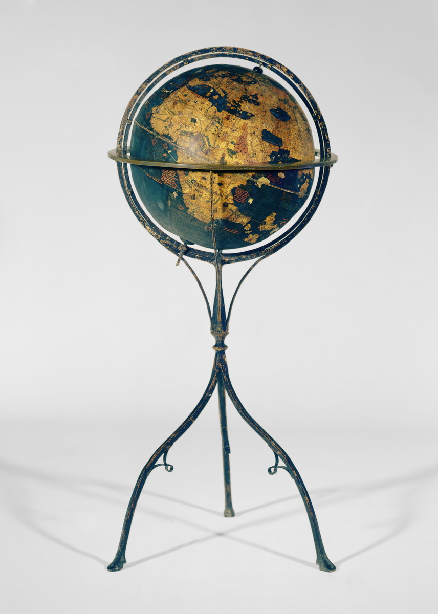
Source: Behaim Globe: Martin Behaim, Georg Glockendon the Elder, and others, Nuremberg, c. 1491–1494. Material/technique: sphere made of various composite materials, opaque colored paint, wrought-iron frame, brass horizon ring. Germanisches Nationalmuseum Nuremberg, Inv.-Nr.: WI 1826. Available online at: https://www.gnm.de/ausstellungen/dauerausstellung/renaissance-barock-aufklaerung/
A facsimile of the globe was printed by Ernst Georg Ravenstein in Martin Behaim: His Life and His Globe. London, 1908, pp. 123–27. Available online at: http://dl.ub.uni-freiburg.de/diglit/ravenstein1908/
© Germanisches Nationalmuseum Nuremberg. Photo: Jürgen Musolf.
Further Reading
Ulrich Knefelkamp, “Globus des Martin Behaim,” published on March 5, 2012; in Historisches Lexikon Bayerns, http://www.historisches-lexikon-bayerns.de/Lexikon/Globus des Martin Behaim (last accessed July 27, 2021)