The First German Road Map: Erhard Etzlaub, This is the Road to Rome (c. 1500)
Abstract
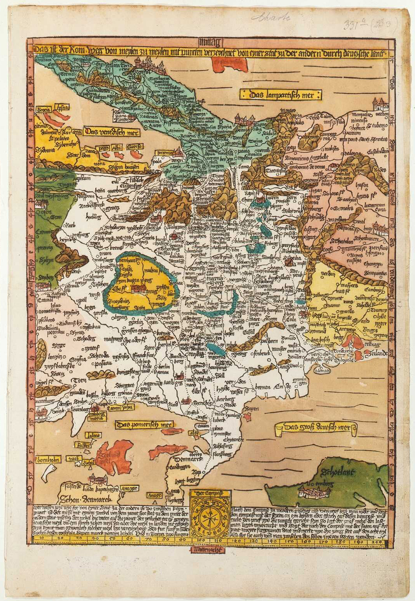
This map of Central Europe by Nuremberg compass-maker and physician Erhard Etzlaub (1460–1532) is the first known German road map. It dates from c. 1500 and was made for the Holy Year of 1500, when many pilgrims were expected to travel to Rome. It is entitled This is the Road to Rome, from one mile to the next, with points marked from one city to another through the German countryside [Das ist der Rom-Weg von meylen zu meylen mit puncten verzeychnet von eyner stat zu der andern durch deutzsche lantt]. As the title suggests, the pilgrimage routes are represented by dotted lines. The map features color-coded language areas and schematic representations of mountain ranges, both of which must have proven helpful not only to pilgrims but also to other travelers, merchants, scholars, and diplomats. The map is oriented to the south and does not mark the borders between the Holy Roman Empire and neighboring kingdoms, making it difficult to determine which territories belonged to the empire.
Source
Source: Erhard Etzlaub, Das ist der Rom-Weg von meylen zu meylen mit puncten veryzeychnet von eyner stat zu der andern durch deutzsche lantt. Nuremberg: Hochfeder-Nachfolger und Georg Glockendon, c. 1500. Munich, Bavarian State Library -- Rar. 287#Beibd.4. Available online at: https://www.digitale-sammlungen.de/en/view/bsb00033752?page=,1
Bavarian State Library
Further Reading
Ute Schneider, Die Macht der Karten: eine Geschichte der Kartographie vom Mittelalter bis heute. Second revised edition. Darmstadt: Primus Verlag, 2006.