Alexander von Humboldt, Cross-section of the Chimborazo (1807)
Abstract
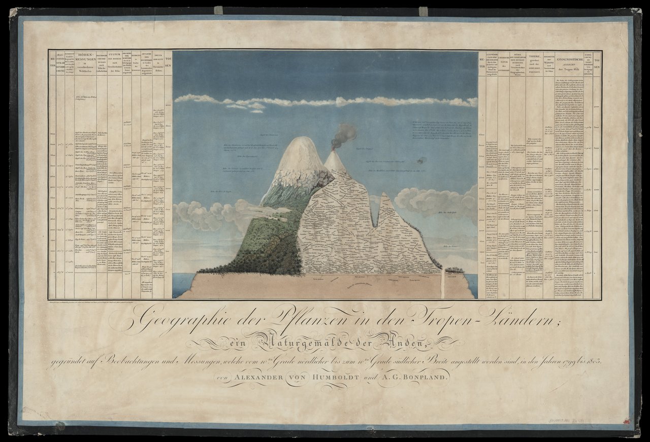
Map of Mount Chimborazo in Ecuador. By depicting plant life according to elevation, this map connects disparate climate zones across the globe. A celebrated polymath, Alexander von Humboldt (1769–1859) traveled extensively in the Spanish colonies of the Americas from 1799 to 1804. His partner on the journey was his French colleague Aimé Bonpland. In 1801, the two ascended Mount Chimborazo as members of a climbing party; they stopped short of the summit but nonetheless set a world record at the time. Toward the end of his long life, Humboldt offered a synthesis of his thoughts on geography and the natural sciences in his multi-volume work, Kosmos: Entwurf einer physischen Weltbeschreibung (4 vols., 1845–58).
Source
Source: Alexander von Humboldt, Aimé Bonpland, Lorenz Adolf Schönberger, Félix Turpin, Bouquet, and L. Aubert, Geographie der Pflanzen in den Tropen-Ländern: ein Naturgemälde der Anden: gegründet auf Beobachtungen und Messungen, welche vom 10ten Grade nördlicher bis zum 10ten Grade südlicher Breite angestellt worden sind, in den Jahren 1799 bis 1803. Tübingen: F.G. Cotta, Paris: F. Schoell, 1807. Zentralbibliothek Zürich, map collection. Available online at: https://uzb.swisscovery.slsp.ch/view/delivery/41SLSP_UZB/12463031310005508
This work is licensed under the Creative Commons Attribution-ShareAlike 4.0 License.
Further Reading
Andrea Wulf, The Invention of Nature: Alexander von Humboldt's New World. New York: Alfred A. Knopf, 2015.