Map: Das Deutschtum im Ausland [The German Presence Abroad] (1931)
Abstract
The following map from the 1931 edition of the “Putzger” atlas (widely used in schools at the time) gives an example of the ideologization of German settlement: With a mixture of linguistic and political arguments, the largest possible area is declared as “German-influenced,” be it as “Volksboden” [German soil], “Kulturboden” [culturally German territory] or as an allegedly homogeneous linguistic area. Incidentally, the far-reaching “area of the German lingua franca in the East” on the bottom map refers primarily to the use of Yiddish. In the first map, the area marked in light gray designating “small German populations” pushes like a wedge into the interior of Asia and also effectively covers large parts of the Americas - without the information being even remotely clarified as a statistical figure. Maps showing the “Auslandsdeutschum” [German settlements abroad] were created even before the late Weimar period, from which these two date. As early as 1900, there were examples of specific atlases of Germanness, such as the Deutsche Kolonial-Atlas and the Alldeutsche Atlas, both produced by Paul Langhans and published by Justus Perthes in Gotha.
Source
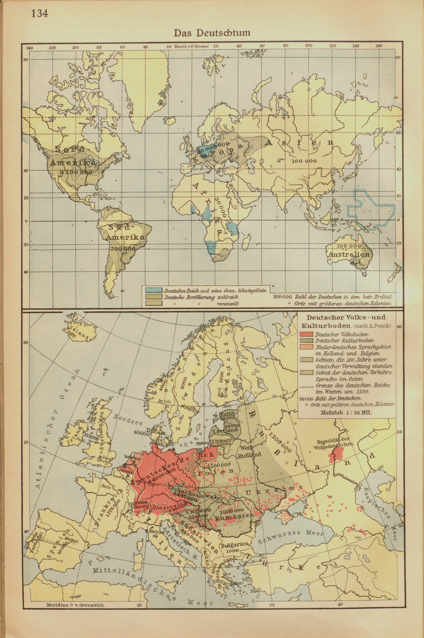
Source: F. W. Putzgers Historischer Schul-Atlas, Große Ausgabe, bearbeitet und herausgegeben von Max Pehle und Hans Silberborth, 50. Aufl., Bielefeld/Leipzig 1931, p. 134.